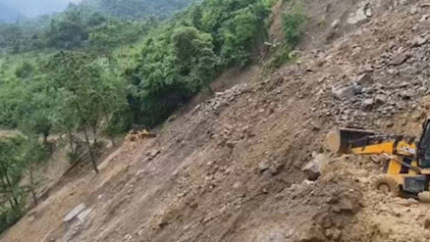
Nashik district collector Ayush Prasad has initiated plans to conduct geological surveys in the areas surrounding a government-run Ashramshala in Bhuwan village of Peth taluka and Neel Parvat in Trimbakeshwar taluka. The move comes as a precautionary measure to mitigate potential landslide threats in these mountainous regions. The decision was made after considering the safety and well-being of the students and staff at the Ashramshala, as well as the local residents. The surveys will help identify areas prone to landslides and enable the authorities to take necessary steps to prevent or minimize the risks associated with such natural disasters.
Geological Survey and Its Importance
The geological survey will involve a thorough examination of the terrain, geology, and hydrology of the areas in question. This will help the authorities understand the underlying structure of the land and identify potential weaknesses that could lead to landslides. The survey will also take into account the impact of human activities, such as construction and deforestation, on the environment and the likelihood of landslides. By conducting such a survey, the authorities can gather valuable data and insights that will inform their decision-making and help them develop effective strategies to prevent or mitigate landslide risks.
The importance of geological surveys cannot be overstated, especially in regions prone to natural disasters like landslides. These surveys provide critical information that can help save lives, protect property, and prevent environmental damage. In the case of the Ashramshala in Bhuwan village, the survey will help ensure the safety of the students and staff, while also protecting the surrounding environment and infrastructure. The survey will also serve as a model for other regions in Nashik district, where similar geological surveys can be conducted to identify and mitigate landslide risks.
Prevention and Mitigation Efforts
The district collector’s decision to conduct geological surveys is part of a broader effort to prevent and mitigate landslide risks in Nashik district. The authorities have already taken several steps to address the issue, including the creation of a disaster management plan and the establishment of an early warning system. The plan outlines the procedures to be followed in the event of a landslide, including evacuation protocols, emergency response measures, and relief operations. The early warning system, on the other hand, will provide critical alerts and updates to residents and authorities in the event of a landslide, enabling them to take necessary precautions and respond quickly to emergencies.
In addition to these measures, the authorities are also working to raise awareness about landslide risks and the importance of preparedness. This includes educating local residents, students, and staff about the warning signs of landslides, the importance of evacuation drills, and the need for emergency preparedness. By taking a proactive and multi-faceted approach to landslide prevention and mitigation, the authorities in Nashik district are demonstrating their commitment to protecting the lives and property of residents and ensuring the long-term sustainability of the region.
Future Plans and Collaborations
The geological surveys in Peth and Trimbakeshwar talukas are just the beginning of a larger effort to address landslide risks in Nashik district. The authorities plan to conduct similar surveys in other regions, using the data and insights gathered to inform their decision-making and develop effective strategies for landslide prevention and mitigation. The district collector has also announced plans to collaborate with experts from various fields, including geology, hydrology, and environmental science, to gain a deeper understanding of the complex factors that contribute to landslides and to develop innovative solutions to address these risks.
Furthermore, the authorities are exploring opportunities for collaboration with neighboring districts and states, where similar geological surveys and landslide prevention efforts are underway. By sharing knowledge, expertise, and best practices, the authorities in Nashik district can learn from others and develop more effective strategies for addressing landslide risks. The district collector’s initiative has the potential to serve as a model for other regions, demonstrating the importance of proactive and collaborative approaches to disaster prevention and mitigation.
The decision to conduct geological surveys in Peth and Trimbakeshwar talukas is a significant step towards ensuring the safety and well-being of residents in Nashik district. By taking a proactive and multi-faceted approach to landslide prevention and mitigation, the authorities are demonstrating their commitment to protecting lives and property, while also promoting sustainable development and environmental stewardship in the region. As the surveys get underway, residents and authorities alike are eagerly awaiting the results, which will provide critical insights into the geological risks and opportunities for mitigation in these mountainous regions.